Wednesday, June 27, 2012

Newfoundland

Thinking back to when I was a child, I believe my impression of Newfoundland was akin to my impression of Greenland and Iceland: a desolate island in the North Atlantic populated by native Americans (I’m sure I called them Indians or Eskimos), seals, moose and puffins. It was a long time ago, of course, but I assume my impression was based on articles in National Geographic and maybe “nature” films I saw in elementary school. That impression has now changed.

But I’ll begin describing this part of the trip with the ferry. The one we were on is 656 feet long and has 9 decks, including 3 vehicle decks. It can carry a huge number of 18 wheelers, and the deck we drove onto looked like the hangar deck of an aircraft carrier.DSC_0046 The ship is the M/V Highlanders and is one of two sister ships that went into service in 2011, so its virtually brand new. I couldn’t get a good picture of the ferry because when I attempted to get a better angle I was chased by a security guard.
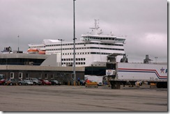
The ship has 96 cabins and 500 comfortable airline-type seats—wider than those on planes, and with a lot more legroom. The trip took 6 hours, and departed at 11:30am. There’s also a late-night trip, which explains the cabins.

For folks who live on the southwest part of the island, the ferry is pretty much the only public transportation to the mainland. The one-way fare for a car is $105.00 plus $40 per passenger, each way. There are no round-trip discounts or discounts for residents, which makes traveling to the mainland a fairly expensive proposition for residents. Those fares are a subject of much discussion for the Newfoundlanders. The fare for our truck and trailer worked out to a bit over $350 each way.

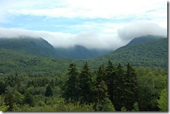
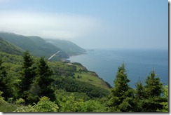
Okay, enough about getting here. Newfoundland consists of a lot of wide-open spaces, beautiful mountains, and spectacular scenery. The cloud-topped mountains along the section of  the Trans Canada Highway,  which is one of very few main roads on the island, between the ferry and our campground,  look like the mountains of Maui, without the palm trees.DSC_0057 And what I’ve written about the warm and friendly people of Canada goes double for Newfoundlanders (or Newfies). They’re known as the funniest Canadians (just ask them).
Everyone we’ve met seem truly interested in who we are and where we come from, and want us to learn about their province. By the way, the name of the province is “Newfoundland and Labrador”, but the Labrador part is on the mainland next to Quebec. I never knew Newfoundland and Labrador were a combined province. Just one of many things I didn’t know about Canada.
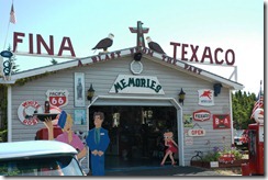
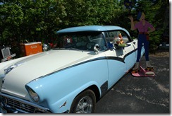
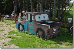
DSC_0050While driving around here we came across a local “museum” which is set up in a small garage. It’s really a hobby for a retired Newfie and consists of some restored antique cars (and I use the term advisedly since his featured Ford is newer than my first car), DSC_0051some restored gas pumps, and a few home made (of wood) half-size model cars and trucks. We had a nice chat with the owner who told us a bit about that part of Newfoundland. By the way, the correct pronunciation is New-fund-land, with stress on the last syllable. Its Newfundlaaand, not Newfundlind as we tend to pronounce it in the States. DSC_0056
We had a substantial rainstorm last night, with very heavy winds. There’s an article in the local travel brochure that warns about the danger of driving in the area when high wind warnings are posted. Apparently 18-wheelers have occasionally been blown off the road, and years ago a bunch of loaded rail cars met that fate as well. We’ll try not to tow the trailer around here when there are wind warnings posted. There’s a park about 30 miles up the road where moose and bears can often be seen. We just headed there, but the rain resumed in deluge proportions, so we turned around and returned to the campground.

Tomorrow we’ll head to the national park in the northwest part of the island where the terrain is supposed to look a lot like Scandinavia, complete with fjords.  Hopefully, the weather will improve.
Sunday, June 24, 2012

Cape Breton Island

We’re just wrapping up a week on Cape Breton Island, which is the northeast corner of Nova Scotia. The weather has been okay for most of the week, but we have had on and off rain. Today (Sunday) it’s been raining all day. A highlight of this island is the Cabot Trail, which is a loop road of about 150 miles traversing the Cape Breton Highlands, thus named because they reminded the original Scottish settlers of the highlands at home. DSC_0041

The trail runs along the Atlantic coast and is quite pretty. There was a fairly heavy fog  just off shore, so we didn’t see any of the whales that allegedly frequent these waters at this time of year. Neither did we see any of the moose or eagles that supposedly hang out here.  Penny and I have decided that, just as in Maine, the Canadian moose exist only on the signs that warn you not to hit a moose with your car. Tomorrow we’re going to Newfoundland which is supposed to be loaded with moose, so we’ll see. (I’ll have more on the trip to Newfoundland later.

DSC_0043

The Cabot Trail also runs through some picturesque fishing villages where the local fishermen are currently busy trapping lobster. The lobster season ends this week, so they gotta catch lobster when the catching is good. In case you were wondering (I know I was) why is the road named the Cabot Trail: Well, at lunch today we found out. The restaurant placemat had some historical information about Cape Breton and it mentioned that the area was discovered (if you don’t count the Indians who where here first)  in the  early1700s by a couple of explorers named Cabot.

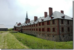
One of the fishing villages on the opposite side of the island from the Cabot Trail is called Louisbourg. I would have named it Lewisburg, but since it was founded by the French, it uses the French spelling. Anyway, the French built a fortress here in 1744.

DSC_0022

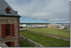
Within a few years England decided Canada should be part of the Empire, so they attacked Fortress Louisbourg and sent the French military back to France. Over the following years the Fortress fell into disrepair, and pretty much disappeared. Aside from fishing, the big industry on Cape Breton used to be coal mining. In the 1950s, oil had replaced coal as the primary fuel, and the mines closed, leaving thousands of miners unemployed. The Canadian government got a brainstorm…put the miners to work rebuilding Fortress Louisbourg as a tourist attraction.

The building foundations were still in place, and France, apparently willing to let bygones be bygones, gave to Canada thousands of pages of plans and documents describing the original Fortress. So, with the supervision of a few old-timers who knew the old construction techniques, DSC_0027the out-of-work miners resurrected the fortress on its original site. Fortress Louisbourg remains one of the largest historical reconstruction sites in North America.

Local folk still work at the fortress as guides and  costumed re-enactors.DSC_0002

This lady, and no, the French did not have female soldiers in 1744, did a musket firing demonstration. Her gun refused to fire in her first four attempts. Number five worked, but by then, the British would have already moved into the barracks.

Aside from the misfires, the employees at the Fortress where extremely friendly and knowledgeable about the history of the area and were very willing to answer questions from the silly tourists. While we were visiting the Governor’s Quarters a French naval officer snuck up on us and explained why he was visiting the Fortress (his ship was being repaired). He came across as a pompous ass, but he WAS portraying a 1744 French naval officer.

BellMuseum2011

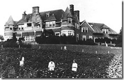
Another popular tourist spot on Cape Breton is the Alexander Graham Bell Historic Site. Bell had a summer house here, and we thought it was open to the public.  Turns out the Site is a small museum which touches on his telephone work, but mainly features the research Bell did on flight and hydroplanes. I didn’t even know the Father of the Telephone did research on flight, which proves once again that one is never too old to learn something new.

BeinnBhreaghCrop

Bell’s summer home, Beinn Bhreagh, which means “beautiful mountain” in Gaelic, remains in the hands of Bell’s descendants  and is not open to the public.

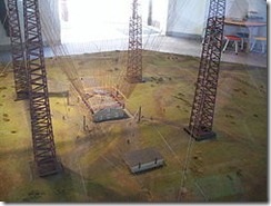
And to round out the communications section of this entry, Giuseppe Marconi made the first transatlantic wireless transmission, in Morse code of course, from Glace Bay, Nova Scotia, where a very small museum is set up on the site where the transmission array once stood. Marconi_tower

This is a picture of a model of the Marconi antenna array. The foundations are still there, and the land is preserved. A volunteer named Jim, who claims to be one of the last people in the Maritimes fluent in Morse code, told us he’d love the government to reconstruct the site and turn it into a significant historical monument, but he doesn’t think it will ever happen.

Tomorrow we leave for Newfoundland. That means a ferry ride across 100 miles of open Atlantic Ocean. The ferry looks more like a cruise ship than a ferry boat, so it should be fun.

Monday, June 18, 2012

PEI II

We’re staying on Prince Edward Island longer than originally planned. There’s an annual music festival on the island which we learned about last week, and since it opened Thursday night, we decided to stick around and attend one of the shows. It’s called the Festival of Small Halls, since performances are held at small venues in some of the small towns around the island. The one we went to was in a town about 45 minutes from our campground and  featured traditional Maritime fiddlers and dancers.  Think Irish roots music. It was sort of like Celtic Woman without the singing, or women; or like Riverdance, without the big production. There were some really terrific fiddle players and a few dancers who, as in Riverdance, manage to dance just from the waist down. It was a sellout and really a lot of fun.

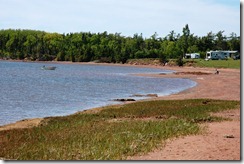
We’re in a different campground now, on the eastern side of the island, and the weather has been picture-perfect. DSC_0463 The place is called Seal Cove, and we’re told seals frolic along the beach at low tide. This picture was taken at low tide…from the spot where the seals are supposed to congregate. We haven’t seen a single seal, although when we returned here after the show we did hear a couple of seal barks. If you look closely at the picture you’ll see a local fisherman digging clams. Also, unseen in the photo are hundreds of floats in the bay marking mussel farms. Who knew mussels were farm raised, but they are. Mussel seeds (so we’ve been told, but I assume they’re really baby mussels) are placed in a nylon mesh bag, called a sock, which is attached to the float and I assume a weight to keep the sock in place. The mussels grow big and strong, and the fishermen come along, scoop them out of the socks, and sell them at the fish market or the local restaurants. Speaking of which, we had dinner in a nice place before the show. Penny had mussels and a lobster which was probably crawling around the bottom of the bay a couple of hours before she ate it.  She said both the mussels and lobster were great. PEI is wonderful, but not the place for fine dining for someone like me with a serious seafood allergy.

DSC_0464

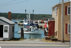
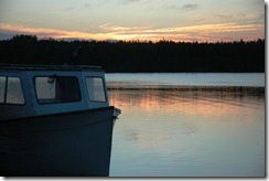
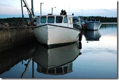
There’s a fishing wharf  about 1/4 mile from the campground and we went there the other evening to check out the sunset. There were about a half dozen of the small commercial fishing boats that ply the local waters for mussels and some species of local fish.

I think the boats in these pictures are primarily mussel boats, but DSC_0466some had sophisticated navigation equipment on board, so I assume they venture away from the sheltered bays where the mussels are farmed. There are lots of lobstermen on the island, but we didn’t see any lobster pots (traps) at this particular wharf. The owner of our campground has an arrangement with a local lobsterman and if any campers want really fresh lobsters he’ll pick them up right at the boat.

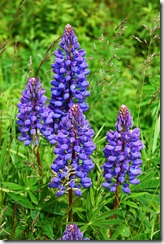
Other features of PEI should be mentioned here. DSC_0474One is the flowers, which I believe are lupine, that seem to grow wild along many roadways. They seem to be in this blue/purple, white and pink, and we’ve seen them depicted in a lot of the local artwork.

PEI is a very rural island, which is known both as the Green Island and the Gentle Province. I guess the “gentle” derives from the really warm and friendly people who live here, but we’ve found nice, friendly folk in all of the provinces we’ve visited.

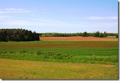
The “green” probably DSC_0447derives from the lush farmland and forests that cover the island between the very few cities and towns. The biggest city is Charlottetown, which, if memory serves, has only about 65,000 residents.

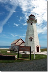
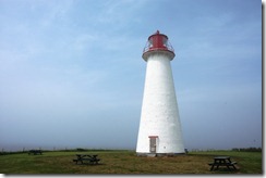
Finally, PEI has a bunch of lighthouses, many of which have been taken over by local civic organizations. Most of these lights were erected in the late 1800s and virtually all of them are no longer functioning. But since we’re here, I figured there might be some sort of requirement for tourists to take a picture of a light house. I took two, and here they are.

DSC_0450

 DSC_0470

Wednesday, June 06, 2012

PEI

No, I haven’t misspelled pie. We’re on Prince Edward Island, the  smallest of Canada’s provinces. The island is roughly 100 miles wide and about 50 miles high. I’m estimating because I’m not very good converting kilometers to miles.

PEI is known for mussels and Anne of Green Gables. We’re currently on the north shore of the western side of the island and it has been cold, rainy and windy every day. We’re heading to the eastern side of the island tomorrow, and the weather is supposed to improve.

DSC_0441

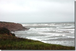
The winds are from the northeast, making for a very angry ocean. The island is really beautiful It’s mostly rural with lots of farms (mostly potatoes) and dairy operations. Also, fishing is a big industry here.

Penny has never liked mussels since the one and only time she tried them, they weren’t very good. But since we’re in the mussel capital of the world, she decided to take another shot. She’s now a convert.

DSC_0445

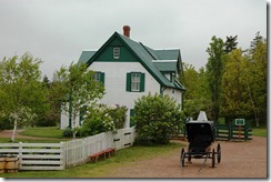
Our campground is in Cavendish, which is the primary resort area of the island and the home of Anne of Green Gables author L.M. Montgomery. Canada National Parks operates the house that inspired the novel as a national heritage site.DSC_0430

The farm house, which actually has green gables, was owned by a distant relative of the author who lived near by. The sylvan setting of the farm, the people of Cavendish, and the beauty of the island were the inspiration for the 1908 novel and several that followed. Many of Montgomery’s books and short stories were written while she lived in Cavendish.

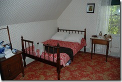
The green gables house is original, but has been restored and DSC_0434furnished with furniture from the late 1800s, the period in which the novel takes place. During the summer, Parks Canada stages demonstrations of farm life of the period.

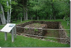
Another feature of the heritage park is the site of the home in which Montgomery lived. It’s a short walk from the green gables house, but that house has been torn down. The cellar was recently excavated, and the overgrown property around the house has been restored and is now open to the public. DSC_0436

Anyone who’s read Montgomery’s work will recognize many of the features of the area surrounding the house in which she lived as well as the green gables house.

Sunday, June 03, 2012

The Tide Rushes In…

And the tide rushes out. And at the Bay of Fundy, it’s quite dramatic. We’re currently in Moncton, NB, which is at the western end of the Bay. When we visited Fundy last year we camped at Fundy National Park, which is about 50 miles east of Moncton. About in the middle, between where we were then and where we are now, is a geographical feature called Hopewell Rocks. The rocks are exposed at low tide, and that’s when folks like to visit. So on the first trip we checked the tide clock and found that low tide would be at 6:30pm. So, on our last day at Fundy we drove about 25 miles to see the rocks. Unfortunately, the park in which the rocks are located closed at 6:00pm and we arrived at 6:05pm. So no rocks.

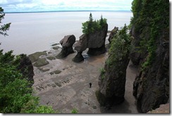
This time we checked both the tide clock and the park closing time, and here’s what we found. DSC_0422

The Hopewell Rocks, and specifically, the Flower Pot Rocks section, are exposed at low tide. The weird erosions are carved in the soft rock by the motion of the extreme Fundy tides, which means at one time the ocean bottom you see in these pictures was up near where the trees and grass are. But that was a few million years ago, so there aren’t any pictures.

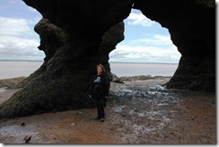
DSC_0424

It’s fun to walk on the ocean bottom anywhere along the Fundy coast. The normal high tide in this area is just above Penny’s head, but since tides are variable, they sometimes get much higher.

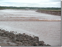
Moncton itself is along the Petticodiac River, which flows into the closed end of the Bay. Since the river feeds into the Bay of Fundy, at high tide the Bay feeds into the river, and it comes in with a fairly impressive wave. Tidal Bore 6 Like the tides that cause the wave, the wave height is variable. What we saw was maybe a foot high. It can be as high as three feet or more at times. The wave is called a Tidal Bore, and the city is kind enough to provide a schedule of it’s arrival times. When we were there it came in right on time at 9:21 am.

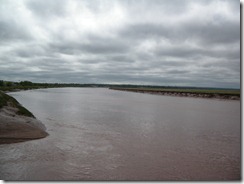
Here’s a shot of the river about an hour later. You can see that the tide doesn’t come in all at once. Petitcodiac River 1 hr after Tidal Bore

I’ve mentioned previously that our two cats aren’t the best of friends. So we were a bit surprised to see the following scene this afternoon. Maybe peace is at hand.

Max and Kitten 1