Tuesday, June 28, 2011

Ontari-Oh

When one lives in the United States, one tends to use the US as a standard for pretty much everything. Now, with the US dollar being worth a bit less than the Canadian dollar, that tendency tends to change. Another thing that changes, and this comes with spending some real time here, is the scale of things. Take states vs. provinces, for example. We consider the western states to be pretty big. When we drove across Texas last year we learned that I-10 across that state was 880 miles. Well, Ontario, and most of the Canadian provinces, are even bigger. And I’m just talking about east to west. Since some of the provinces cozy up against the Arctic Circle, I won’t even mention north to south. For example, the drive from Ottawa to Thunder Bay, both in Ontario, was well over 900 miles. And we still have more than 300 miles to get to the Manitoba province line.

So this blog entry will be extensive.

What have we been doing in Ontario? As mentioned previously, our first stop in the province was Ottawa, the national capital. Now, had we known that Prince William and his new bride would be visiting Ottawa on July 1st, we might have stuck around to say hi. But we didn’t. Ottawa is a very clean and nice city. We did some sightseeing, mostly in the truck, but we walked around the Byward Market, which is a neat shopping area downtown, just a few blocks from Parliament.

DSC_0248

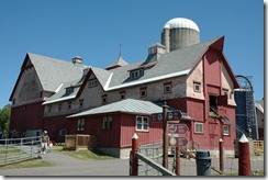
The Central Experimental Farm is a 1200 acre farm within the confines of the City of Ottawa. Its primary purpose is to develop methods of increasing Canada’s agricultural output through scientific research.

Parts of the farm are open to the public, so anyone interested in seeing how a modern dairy farmDSC_0250 operates, this is a fine place to visit. There are several varieties of cows on display, and plaques indicate how each breed differs in milk production, butterfat content of milk, and other variables.
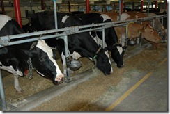
There are also sheep, goats, and pigs on display, and each area has knowledgeable attendants to provide information about the animals.

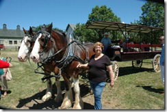
And what visit to a farm would be complete without Penny finding a horse or two?DSC_0252 The farm gives tours in a wagon pulled by a pair of Clydesdales. The driver was a local horseman who was very knowledgeable about the local equines. Speaking of which, when one of the nearby towns celebrated it’s 50th birthday, a local horseman got together a hitch of 50 Clydesdales and drove them through town.  We don’t know if he turned any corners.
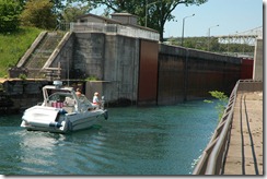
Our next major stop was Sault Ste. Marie, ON, which is at the southeast corner of Lake Superior. SSM is an industrial port town, and the main industry seems to be shipping and preparing products for shipping. DSC_0271 The old canal and lock system on the St. Mary’s River connecting Lake Huron and Lake Superior was once used by the big ore carriers like the Edmund Fitzgerald of Gordon Lightfoot fame. Now, this canal is used for pleasure boats. A newer, much larger canal has been built slightly to the south.
An unexpected surprise in Sault Ste. Marie (and I never did find out why Sault is pronounced Soo) was the Canadian Bushplane Heritage Center which is located in the hangar that was once the home of the Ontario Provincial Air Service, established in 1924 as a forest fire fighting service.  DSC_0258The Heritage Center has an extensive collection of antique airplanes depicting Canada’s aviation history.
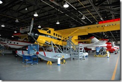
The collection includes bushplanes and firefighting aircraft, some of which are available to be boarded. Just don’t expect to go anywhere in them.

Our next major stop was Thunder Bay, ON, at the northwest corner of Lake Superior. This is a city of 110,000, with a small town feeling. To give you an idea of the size of the biggest of the Great Lakes, the drive from Sault Ste. Marie to Thunder Bay was more than 450 miles, through beautiful mountains, complete with lakes, rivers and streams. Our friend Andy (a Canadian ex-pat)  told us before we left that most of Canada’s population lives in the cities, and there is lots of nothing in between the cities. That’s certainly true, and we’re still officially in eastern Canada.

DSC_0297

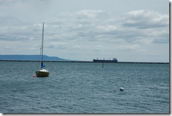
Thunder Bay always sounded like such an exotic place to me, but it turns out to be just another city with a very industrialized waterfront and a small marina. I’m not sure what I was expecting. It seems to be a pleasant enough city and we did find what may be the biggest, most reasonably-priced supermarket we’ve seen in Canada so far, and we’ve seen a lot of them.

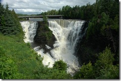
Our campground (Happyland RV Park) is about 15 miles north of the city and just a few miles south of Ontario’s second biggest waterfall. Kakabeka Falls is in a provincial park and is second in size to Niagara Falls. DSC_0288The Kakabeka River, and thus the falls, were once on the trail from the north to Lake Superior, back in the days when the voyageurs travelled through Canada by canoe, trapping furs and shipping them to market. The portage around the falls presented a bit of a problem and they eventually found a better way to the lake.
Tuesday, June 21, 2011

Northern Ontario

We’ve been doing one-night stands north of the Great Lakes on this beautiful part of the Trans Canada Highway. Since we’ve been spending the days travelling, there hasn’t been much to report, except that we keep meeting wonderful, friendly people, all Canadians. We talked with one couple with Florida plates on their motor home, but it turns out they’re really from Ontario. They spent winters in Ft. Meyers.

Oh, we did see a moose along the road today.

Tomorrow we’ll be in Sault Ste. Marie, Ontario, which shouldn’t be confused with Sault Ste. Marie, Michigan, which is across the river. For reasons I hope to have explained, Sault is pronounced Soo.

Parts of the Trans Canada Highway are so rough, pieces keep falling off the truck and trailer. Today it was part of a splash guard on the truck. I sort of fixed it, and I hope it will hang on until we get some place I can spend more time with it. Yesterday, it was a piece of plastic trim from the trailer. We can’t figure out where it came from, but we’ll save it anyway.

Speaking of sort of fixing things, I think I may have mentioned early on my repair to the rear corner of the trailer that was apparently damaged in the shop where we had it to have maintenance done. Anyway, the shaking and vibrating loosened up my repair and the gap between the two panels opened up again. I was lucky enough to find a roll of white duct tape, so now that corner of the trailer is being held together with duct tape. So far, it seems to be holding.

Saturday, June 18, 2011

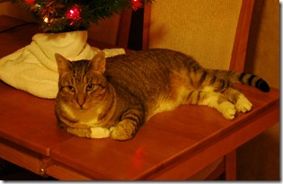
R.I.P. Comet

We’re in Ottawa, Ontario, and it’s turned out to be the final stop for our old cat Comet. He was 14 years old and in failing health due to complications of diabetes. Our vet at home thought the stress of  this trip might be risky for him, and she was right. We hoped he would make it across Canada and home again, but that was wishful thinking.

So, when we arrived in Ottawa yesterday, we knew his time had come. We found a local vet who humanely euthanized him.

As an aside, we were offered various options of funerary urns for his ashes and we reviewed a book depicting various pet cemetery remembrances. We graciously declined. Heck, if we were home we would have buried him in the back field.

Christmas Kitty close

This photo was taken during Christmas of 2009 while we were camped in Las Cruces, NM.

Friday, June 17, 2011

Fundy, Fundy, Can’t Trust That Bay…

The title of this post has nothing to do with our trip, except the Fundy part. I was trying to come up with a rhyme for Fundy, and Sunday popped into my mind, and, there it was.

Anyway, we spent a few days at Fundy National Park, which is about 3/4s of the way from the mouth of the Bay to its end. The park is in a rather remote area of New Brunswick, along one of the worst roads we’ve been on. For a while we thought we were back in New Jersey.

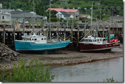
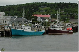
The park is next to the tiny fishing village of Alma, and since it is a fishing (and lobstering) village, it afforded the opportunity to grab the required shots of boats at high and low tide. So here they are:

DSC_0236


DSC_0218


I can’t help but wonder what would happen if a boater from another part of the world docked here at high tide, and didn’t know that low tide would be 30 feet lower.  The tide wasn’t all the way in when I took the high tide picture, but you get the idea.

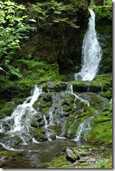
Fundy National Park has a lot to offer beside the view of the bay. There are spectacular woodlands, lakes, streams and waterfalls.  DSC_0232

This waterfall was on a fairly easy loop trail of about .5 kilometers. (When in Canada, measure like the Canadians.)

And speaking of Canadians, absolutely everyone we met in New Brunswick was warm and friendly. We’re in Quebec tonight, just for one night, and the people here are just as nice, although harder to understand. Since my French is limited to oui, non, and parlez vou Anglais? they probably find me hard to understand also. Actually, it’s kind of interesting to drive from one province into another in the same country, and find the traffic signs all in another language. The rest of Canada is bilingual, and all of the road signs are in English and French. But in Quebec, they are all French. Fortunately our GPS speaks to us in English.

We’re currently in a nice campground in an unpronounceable village on the St. Lawrence River, and the TV here picks up about 12 stations. Only one is in English.

I don’t know if it’s because we’ve been travelling mostly in small towns or it’s just a matter of the generally low population density in Canada, but the roads have been like driving on I-78 on a Sunday, at 3am. Traffic is extremely light, even on the major highways. Tomorrow we’ll be heading to Ottawa in English-speaking Ontario, but to get there we have to go through French-speaking Montreal, and the route seems to be complicated. Hopefully, our GPS won’t lead us astray.

Monday, June 13, 2011

More Fundy Fun

We spent a few days at St. Andrew by the Sea, New Brunswick, which is really by the Bay, Bay of Fundy, that is. The weather was great, and St. Andy is a cute little town. It seems that every time we’ve looked at the Bay, the tide was out, but now we have a tide chart, so we’ll probably get to see it when its in.

St. Andrew has a very nice garden called Kingsbrea Garden. Penny things brea refers to some sort of underwear, but I can’t imagine a garden would be named after the king’s underwear.

DSC_0195

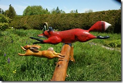
The garden had just wrapped up a sculpture exhibit while we were there. There were some pretty nice pieces, nothing to compare with the stuff at Grounds for Sculpture in New Jersey, but nice, just the same.

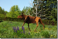
 DSC_0194


The metal moose was somewhat special because its the only moose we’ve seen in Maine or Canada. There are lots of signs warning about moose in the road, but the moose apparently have read the signs and are staying away from traffic.

DSC_0193

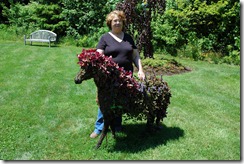
Penny even found a little horse in the garden. I do try to avoid horses as much as possible on these trips, but some times one just shows up. This one was sort of a topiary with flowers.

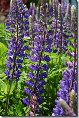
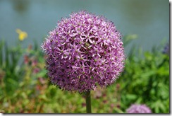
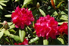
Oh, and since this was a garden, there were also lots of flowers. The species are planted so there are some blooms visible during all of the Spring, Summer and Fall. What follows are pictures of some of the Spring varieties. Don’t ask me what they are, because I don’t know.

DSC_0177

DSC_0182


DSC_0192


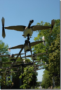
This being Canada, there was also a flock of Canada geese in the garden. These are the good kind of Canada geese, the ones that don’t make a mess all over the place. This was the winning sculpture from last year’s show.

DSC_0176

Wednesday, June 08, 2011

Camping Near Campobello

I’m not old enough to remember Franklin Delano Roosevelt’s presidency, but for some reason I recall hearing about Campobello as the place he used to go for summer vacations. It turns out that Campobello is an island in Canadian waters, just off Lubec, the easternmost town in Maine. Campobello Island and Lubec are on the mouth of the Bay of Fundy, that famous Canadian bay in which the difference between high and low tide is more than 50 feet in some places.

DSC_0153

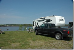
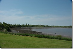
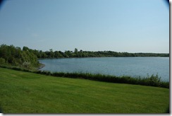
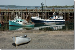
Our campground is a lovely little place in Lubec surrounded by water on three sides. The park bills itself as the easternmost campground in the US, and since it’s in the easternmost town in the US, the claim is probably true. Even at the mouth of the Bay of Fundy, the tides are really amazing. Below are photos from our campground at low and high tide. You can see the difference.

DSC_0156DSC_0173 FDR’s parents vacationed on Campobello Island when Franklin was just a baby, but he came back to the island every summer up until his early years in the White House. At the time, the only way to reach the island was by boat. Now, the FDR International Bridge spans the narrow waterway between Lubec and Campobello Island. And since the island is in Canada, there is a border crossing at the bridge. In July and August, a ferry connects the island with Deer Island in New Brunswick, but other times the only way onto this piece of Canadian soil with a motor vehicle is from Maine.

DSC_0158

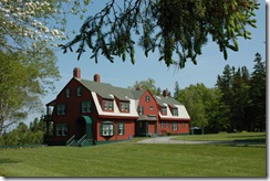
The Roosevelt cottage is within an international park funded by both the US and Canadian Government. It was sold to a private family by Elliot Roosevelt, one of FDR’s sons. In the 1960's the family that bought it  turned it over to become a park which is open to the public at no cost. DSC_0159

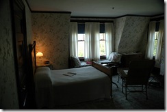
Many of the furnishings and artifacts, like those in FDR and Eleanor’s bedroom were Roosevelt possessions.  The house and visitor’s center have lots of historical photos of the family enjoying their summers at Campobello. An interesting aside (to me, at least) – there are many photos of son Elliot Roosevelt as a boy. I actually interviewed Elliot a few times when he was Mayor of Miami Beach. If I recall correctly, he was highly unqualified for public office when he ran for the Mayor’s seat. My grandparents were living in Miami Beach at the time, and I knew my grandfather was going to vote for him. When I asked him why he said: “He’s Roosevelt!” At that time, on Miami Beach, that’s all one needed to get elected.

Aside from the Roosevelt cottage, Campobello is a lovely island.

DSC_0165

Evidence of the extreme tides are visible wherever you can see water, especially when the tide is out. I guess the local fishermen learn early to tie up their boats with very long lines.

DSC_0170

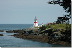
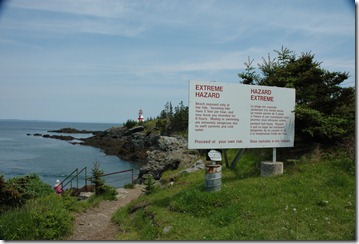
There are several picturesque lighthouses on the island. The one in this photo can be reached only at low tide because the path to it is under several feet of water at high tide. The province is nice enough to warn tourists that planning to spend a long time at the light house could be problematic.

DSC_0166

Sunday, June 05, 2011

Is It Dessert or Desert?

Well, Mt. Desert Island is spelled like a hot, dry place, but is apparently pronounced like an after-meal sweet. At least, that’s the way the captain of our tour boat pronounced it.

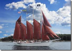
Margaret Todd

The 151 foot Margaret Todd is a 4 masted schooner that sails out of Bar Harbor.  Although the Todd is modeled after a type of ship that hauled freight in the 1800s she was built in the 1970s to haul tourists, and that’s what she still does. I didn’t take this picture because it would have been difficult to be on the ship and take a picture of it at the same time.

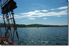
DSC_0146 The cruise was a very relaxing way to see some of the smaller islands off the Coast of Mt. Desert Island. Some of these smaller islands are owned by Acadia National Park, and some are in private hands. The islands closest to Bar Harbor are the Porcupine Islands, and at one time there were small communities on them. Now, there are a few summer homes, but no full-time residents. The Cranberry Islands, which are on the other side of Mt. Desert Island, do have some permanent and summer residents.

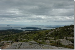
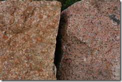
DSC_0117  Much of Mt. Desert Island is taken up by the National Park. The highest mountain in the park is Mt. Cadillac, and there’s a road to it’s top, which is a good thing because there’s no way we would have been able to hike to the top. Most of the mountains on the island consist of granite, which was quarried here for many years. A lot of the Mt. Cadillac granite is pink, which is probably the reason it was a popular object of quarrying. DSC_0123

Since the mountains are now located within the National Park, the remaining granite won’t be gracing anyone’s kitchen in the foreseeable future.

On Monday we’ll be taking the truck to the closest Ford dealership, which is 50 miles away in Bangor. If the exhaust filter issue can be dealt with then, we’ll be heading to Campobello Island on Tuesday.

Friday, June 03, 2011

Baa Haa Baa (Bar Harbor)

The downeasters sure talk funny. Anyway, we’ve been touring Acadia National Park and other areas of the island. Photos are still in the camera, and the camera is in the truck, so I’ll post them later this weekend.

I’m always awe-struck at the incredible beauty and diversity of the national parks, and Acadia is no exception. Not the same kind of grandeur as the parks in the west, but pretty amazing just the same.

Bar Harbor is the old-money town on the island that was once a summer home of families with names like Rockefeller and Ford. Many of those families donated the land that now makes up parts of the park. Today, Bar Harbor is nothing like it was in the past. More tee shirt shops per block than any New Jersey boardwalk, but there are lobster boats in the harbor.

I’ll have more on the island when I retrieve the photos from the camera.

Wednesday, June 01, 2011

Black Flies and Rain

We’re in Southwest Harbor, Maine, which is on Mt. Desert Island, which is where Acadia National Park is Located. We were planning to spend just a couple of days here, but I’m uncomfortable with an issue with the truck which  I need to have looked at before we head into the Great White North.

We’re at a nice campground in the less-touristy part of the island, meaning away from Bar Harbor. We were a bit surprised by the black flies which swarmed all over us when we set up camp. Those little suckers bite worse than skeeters. And we’ve had a bit of rain, but that’s not surprising for this time of year here.

The truck issue – a couple of months ago I received a recall notice from Ford telling us to bring the truck in to have the power system reporting module recalibrated. This is the computer chip that reports certain engine functions and malfunctions. One of the things it reports is “Cleaning Exhaust Filter” which, prior to the recalibration, occurred a couple of times with each tank of fuel, maybe every hundred miles or so. This is part of modern diesel engines that makes them run cleaner – no clouds of black smoke like in older diesels.

But since the recalibration the “Cleaning Exhaust Filter” indication hasn’t come on once, and we’ve driven more than 600 miles since the service was done. The truck is running okay and no warning lights are coming on, but I don’t want to head across Canada with what may be a budding malfunction. I can’t imagine breaking down in the middle of Manitoba or, even worse, in Quebec where many people like to make believe they don’t speak English.

Anyway, the next available appointment at the closest Ford dealer is Monday afternoon, so we’ll be touring this island for a bit longer than planned. It may not even be a problem, but then again, it might be, so based on previous experience, we decided to stick around and have it checked out.

The campground has good wifi and cable TV, and there’s lots to see in the area, so all is fine.

Our next planned stop will be Lubec, ME, which is the entrance to Campobello Island, FDR’s summer retreat. I never knew FDR retreated to Canada, but the Roosevelt Estate is now an International Park, one that requires a passport to enter, even though the only way off the island is back to Lubec, Maine. There is a ferry on the Canadian side, but that only runs during July and August.